St. Augustine, Palm Coast, then. . . home

12-14 St. Augustine

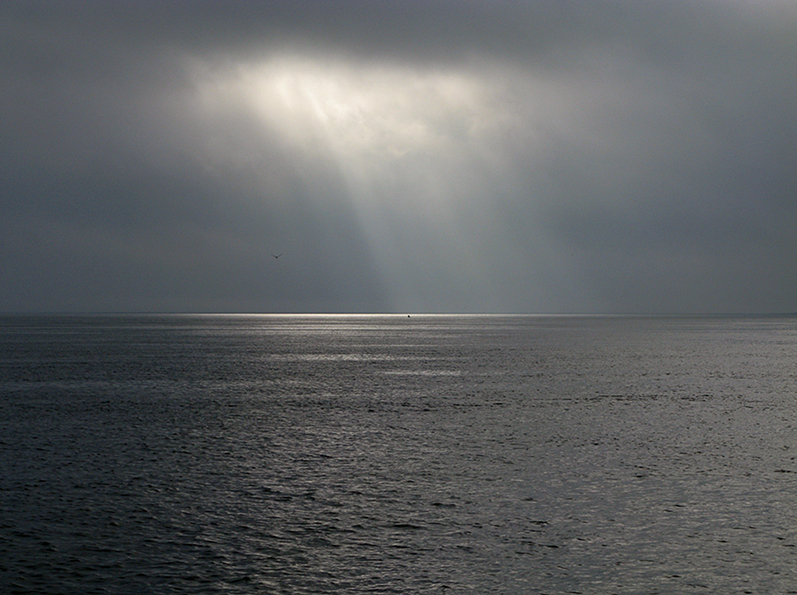
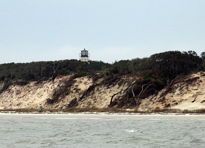
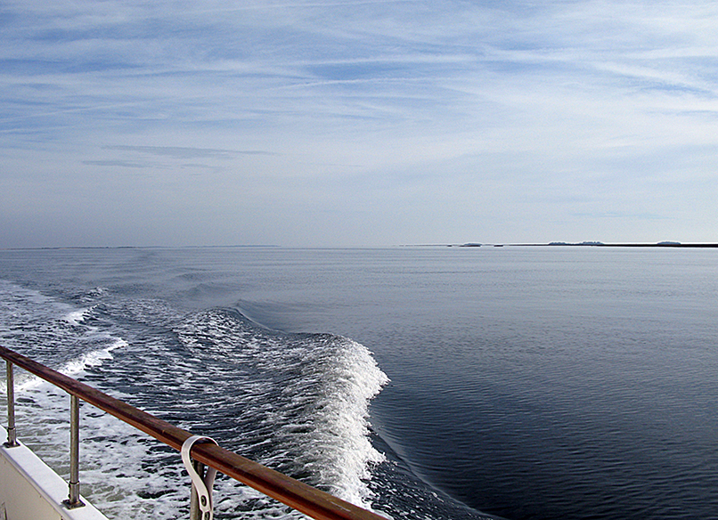
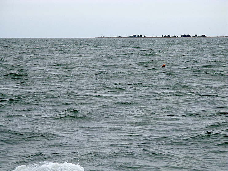
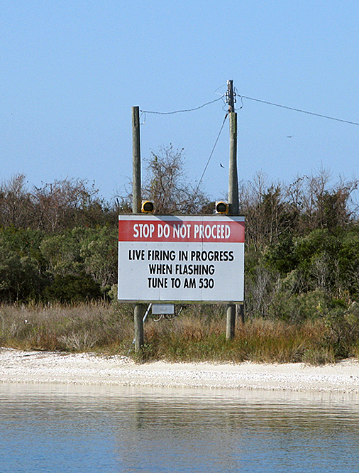
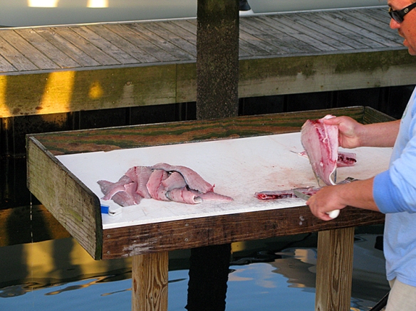
Today we are in St. Augustine. WOW what a current coming in the inlet!! This is what it looks like on a floating mark. . . .

Image

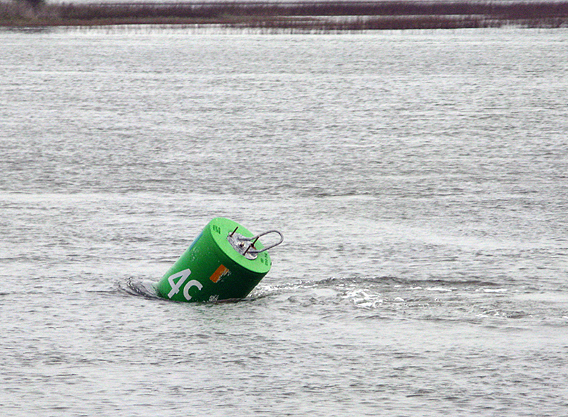
and this is what it does to our speed:

Image

Remember, our “normal” speed is 8.5, we were FLYING! Can I just tell you, this was a scary inlet, with water going fast in every direction. When it can push a 30,000+ lb boat in every which direction, you understand the power of it.

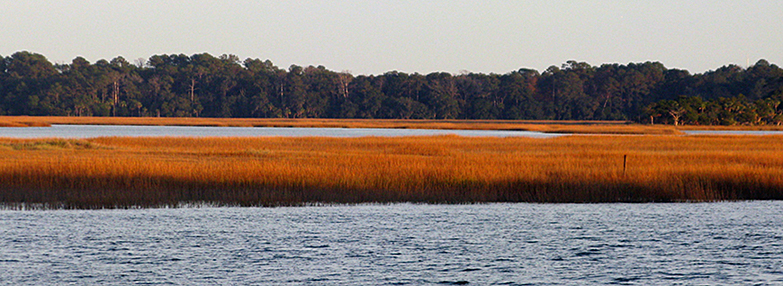
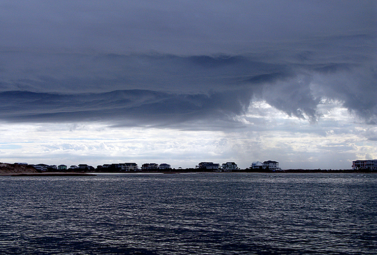
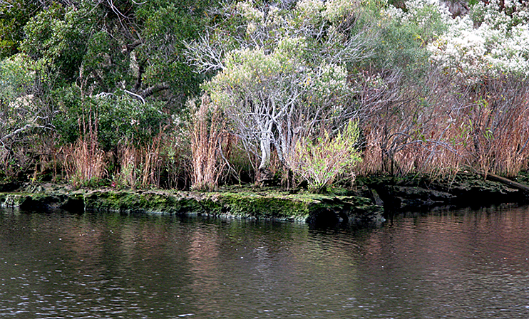
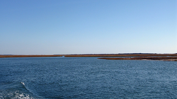
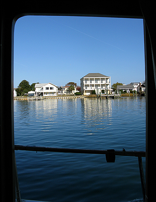
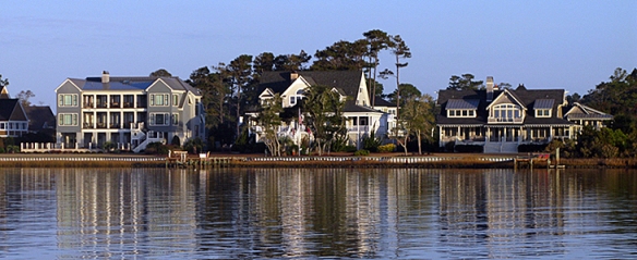
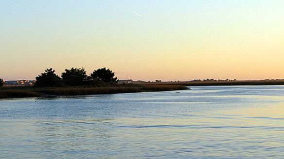
To backtrack just a bit, the long cut approach to St. Augustine is interesting. This whole long stretch is soup to nuts in housing. Again.

Image

Image

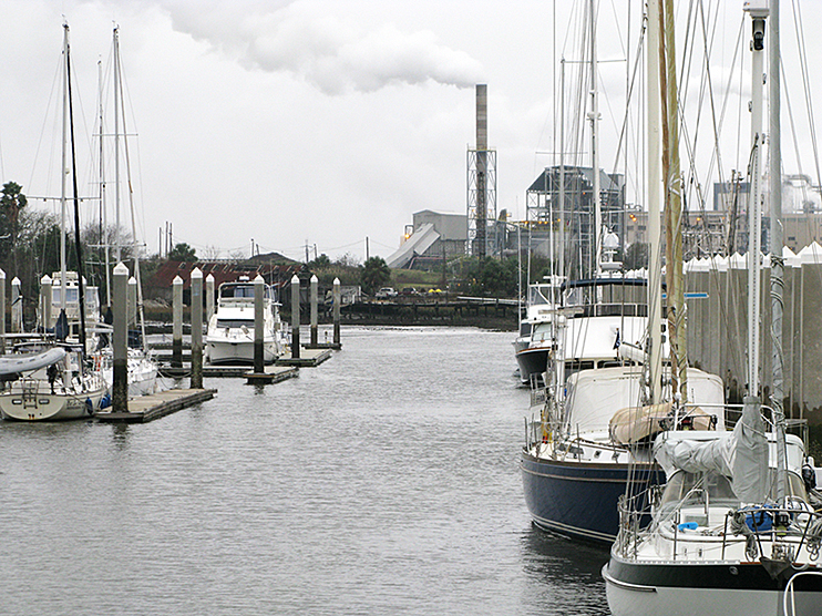
We are staying in a small, “down home marina” on the BACK of St. Augustine proper. Our friends Jim and Judy Foster told us about it (less expensive, more sheltered, which is great because the wind has been howling and the seas rough!) and when we looked it up we found out that you can have a fuel truck come and deliver fuel right to the dock. So when we called for a reservation we asked if they could arrange for that, which they did. For a GREAT price, too! “ONLY” $3.65 per gallon including tax.  We took on 300 gallons. . . .

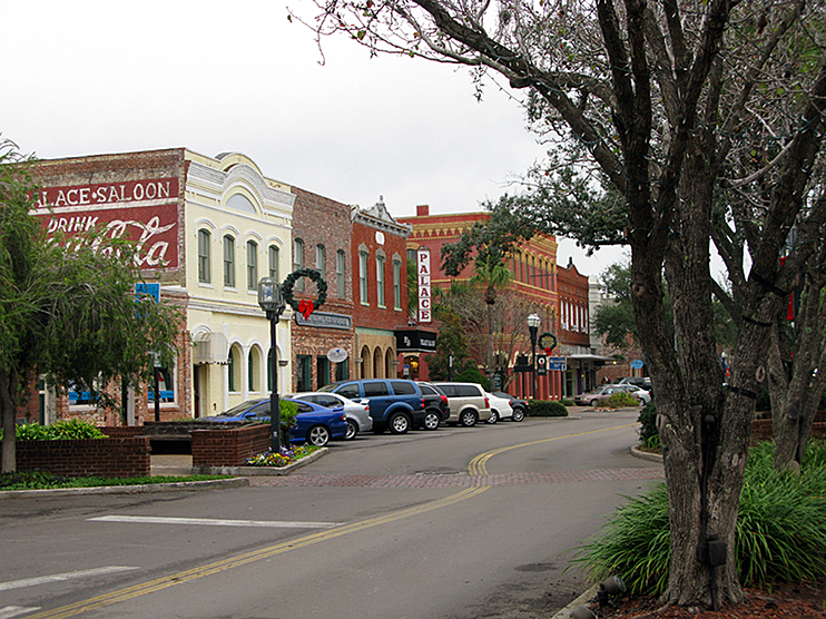
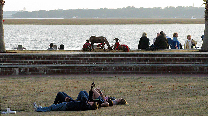
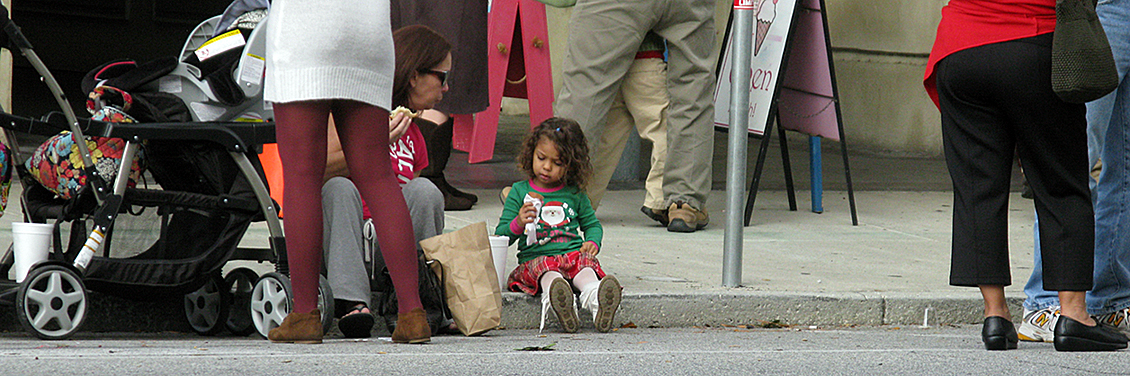
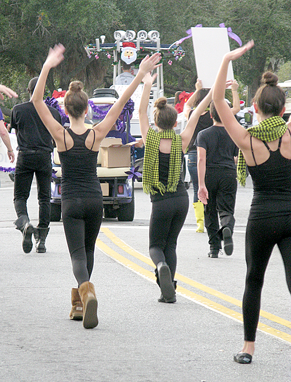
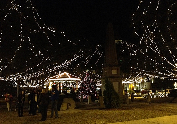
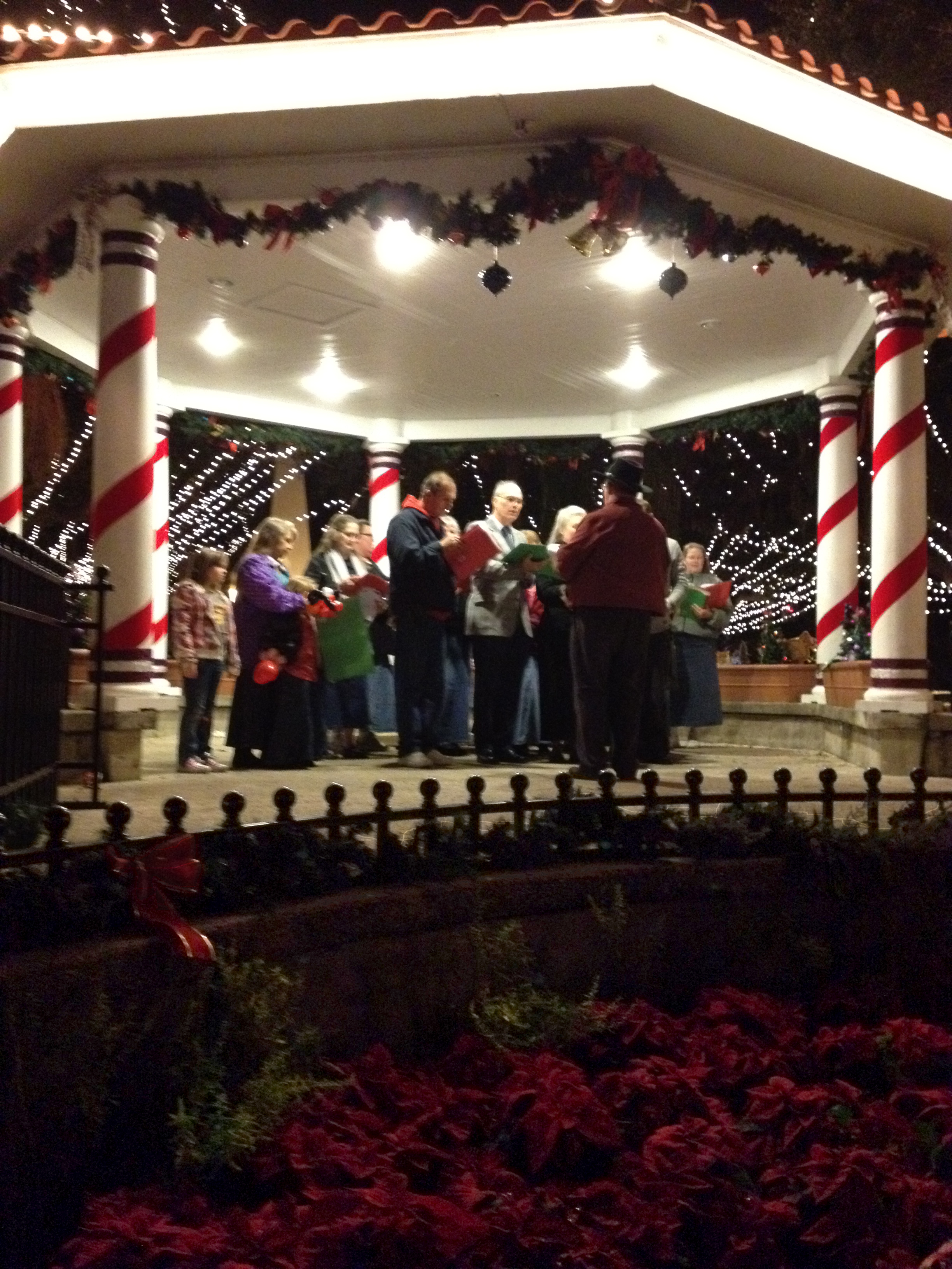
And Jim and Judy (and her sister Joan) were here with their car. Jim took me for a quick trip for groceries (good lord, we were out of Milk Bone dog biscuits, that would never do!) and then suggested that we join them for dinner in town and to see the lights. WOW! ST. AUGUSTINE WITH CHRISTMAS LIGHTS IS AMAZING!!!

Image

Image

Image

Image

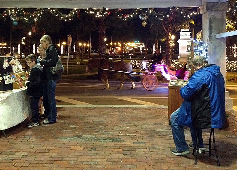
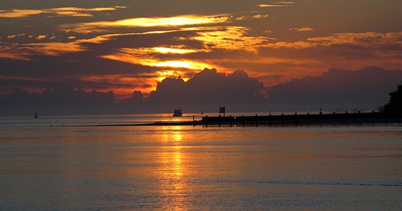
Here is the famous Bridge of Lions

Image

The entire city seemed alight with celebration, activity, and oh yes, LIGHTS! Jim said he thought there were supposed to be over a million lights, and we believe it.

++++++++++++++++++++++++

12/15 Hans’s Birthday!

Morning started with Dunkin Donuts coffee and donuts in the marina office, and a gathering of live-aboards and transients outside sharing war stories. A nice touch! I walked over to the produce stand that is just outside the entrance to the marina and bought the most incredible tomatoes, juicy grapefruit and some gigantic oranges. . .

Image

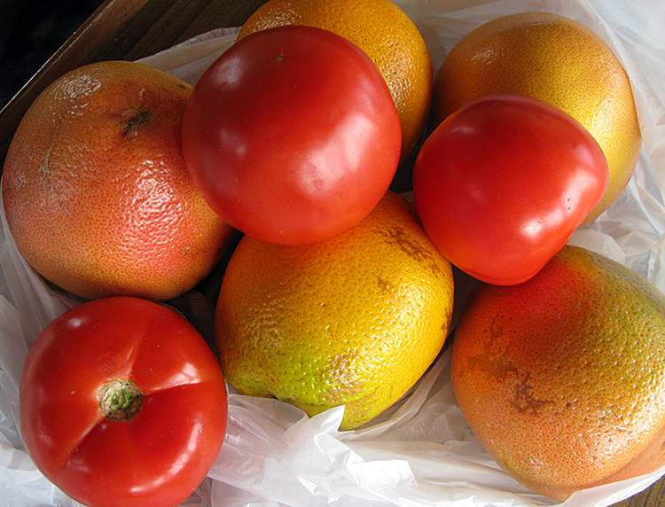
. . .all for $5. I think I would have had to pay $5 just for those tomatoes back home!

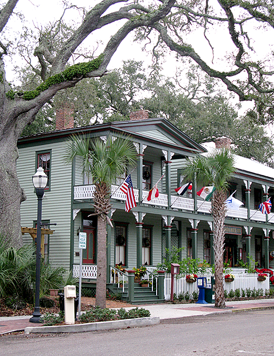
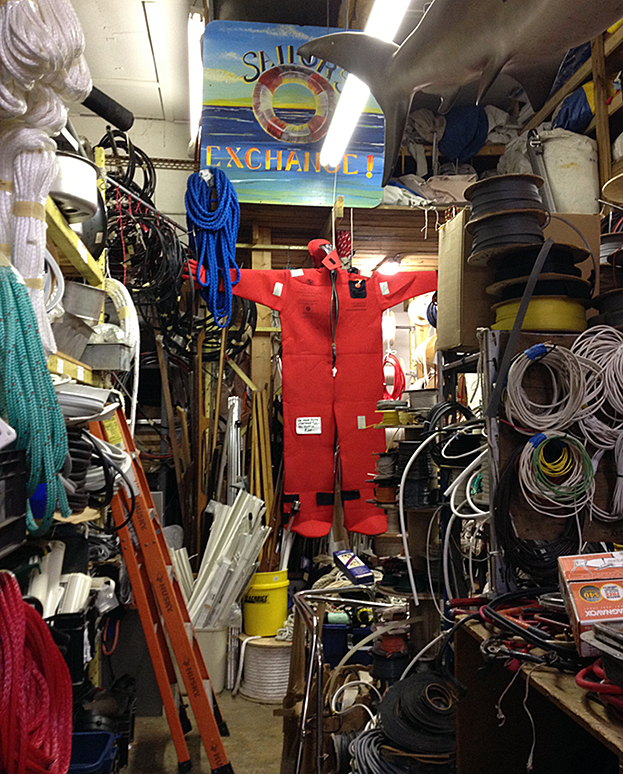
We decided that THE best birthday celebration for Hans would be the walk to Sailors’ Exchange, about three city blocks away, and a no-pressure, no-timeline visit there.

Image

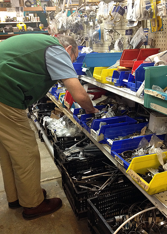
When we found Sailors’ Exchange it was everything that was promised and more. If you’re looking for a bronze hinge for a gate in the railing of a Taiwanese trawler like ours. . . how many, which side, and how big? There was so much there that you couldn’t buy anything. But it was cool.

ImageWhen we’ve lived this life for another couple of weeks or months, we might be able to wrap our heads around what they had there, and buy something.

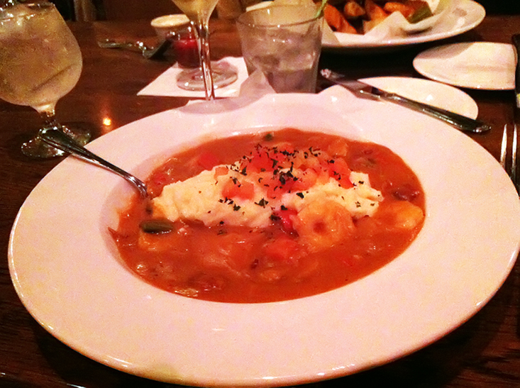
Then lunch at Hurricane Patty’s which is right on the marina grounds. It’s great to be able to stop by for Nachos or Fish and Chips, our choices. Unfortunately the clientele has a tendency to leave food in the parking lot, a total and complete distraction for Niya, who cares more about her stomach than her bladder!

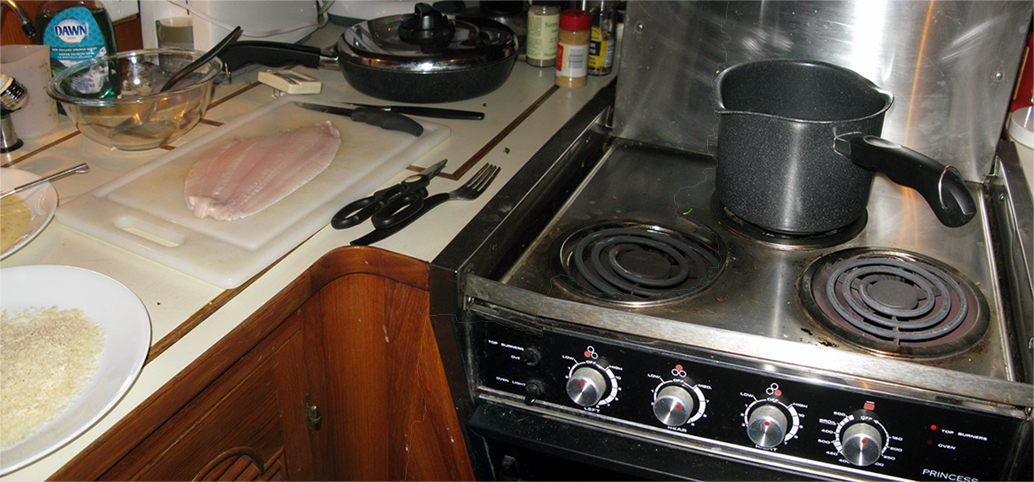
We had “Danish” open face sandwiches for dinner — who else gets to prepare their own meal on their birthday, I ask? Curried herring on black bread, egg, tomato, mayo and caviar on white bread, and if you can get that far you’ll have liver pate and sweet pickled cucumber called Asier.  All of COURSE with schnapps and beer, a Danish delight. Happy Birthday Hans!

++++++++++++++++++++++++++

12-16 to Palm Coast

THEN, a short, three hour trip to Palm Coast.

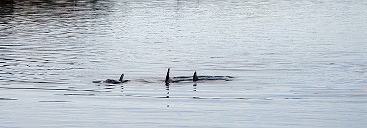
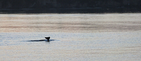
We have seen dolphin all along, but they haven’t seemed very interested in us, so “photo-ops” have been difficult at best. Dolphin usually love to ride the wakes on boats going through their area, and whether ours just wasn’t big enough, or fast enough for them, we didn’t know. But suddenly we drew them on this leg of the journey. There were five of them, and Hans went out with the whistle and they stuck around for a good fifteen minutes or so.Image

Image

What made it even more fun was that Hans took Niya out so she could see them. WOW! She was SO EXCITED and she said so, with barks and whines and little leaps, as she watched them weave in and out of our wake. Once she was back inside, she spent the rest of the way standing up on the settee with her paws on the window sill and her eyes glued to the wake, waiting for more.

We had contacted Sarah and Phil Lowe, MTOA folk we’d met years before but never “known,” about the possibility of staying on a neighboring dock for a week or ten days. Sarah and Phil are exceptional in many ways. They received the “Port Captain of the Year Award” this year at the MTOA  (Marine Trawlers Owners Association) Rendezvous. But what did that mean?? We had no idea what a Port Captain does. YIKES!!!!!!!!!!!!! Phil has cultivated a network of neighbors who have docks but no boats. . . and who are willing to exchange dockage for. . . a Purple Martin community? Or maybe help with getting electric power to the dock? Or much more, I can assure you. So he’s got all these “chits” out. When a member of MTOA calls or e-mails, Phil can match it all up. He’s paid for our dockage with his knowledge and expertise, and we are very, very, VERY appreciative. Phil and Sarah are Port Captains of the CENTURY, as far as we’re concerned. They are delightful, intelligent, generous people who have a lot of experience and knowledge to share, and share it they do! We had a wonderful dinner with them, and discovered that Sarah is a fantastic cook, AND baker: the “pumpkin bars” for dessert were amazing.

BUT WAIT, there’s MORE! They have a fenced-in yard and two beautiful little dogs who are READY FOR A RUN!  Niya was beyond happy about this, she was hackles-up-running-hell-bent-for-leather happy about it, and . . . she went “cracker dog.” Poor thing has been cooped up on a boat for three weeks, walked on a leash, dragged away from carrion and chips dropped in parking lots, and she was READY TO GO!  Sarah and Phil’s Casey and Maggie let her loose and gave chase, and joy was produced, happiness smeared across Niya’s grinning, drooling face.  She is now legs up, eyes flickering, whimpering in the chase of her dreams. She’s determined to beat Casey, I know, and we’re pretty sure they’re so equally matched that there will be NO winner!

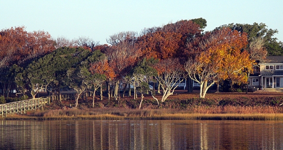
Sarah and Phil live in a lovely quiet neighborhood right on a basin in a community canal. Here is Hans showing his sister Nina what it looks like. (Nina is in Copenhagen, and Hans and Nina have been talking almost every day via Skype, a fantastic benefit of new technologies. She is “almost” going along with us this way!)Talking with Nina

++++++++++++++++++++++++++++++++

12/19 We are home. . .

Phil drove Hans back up to St. Augustine to pick up a rental car Monday morning, and we took two days to do the 790 mile trip back to Maryland.

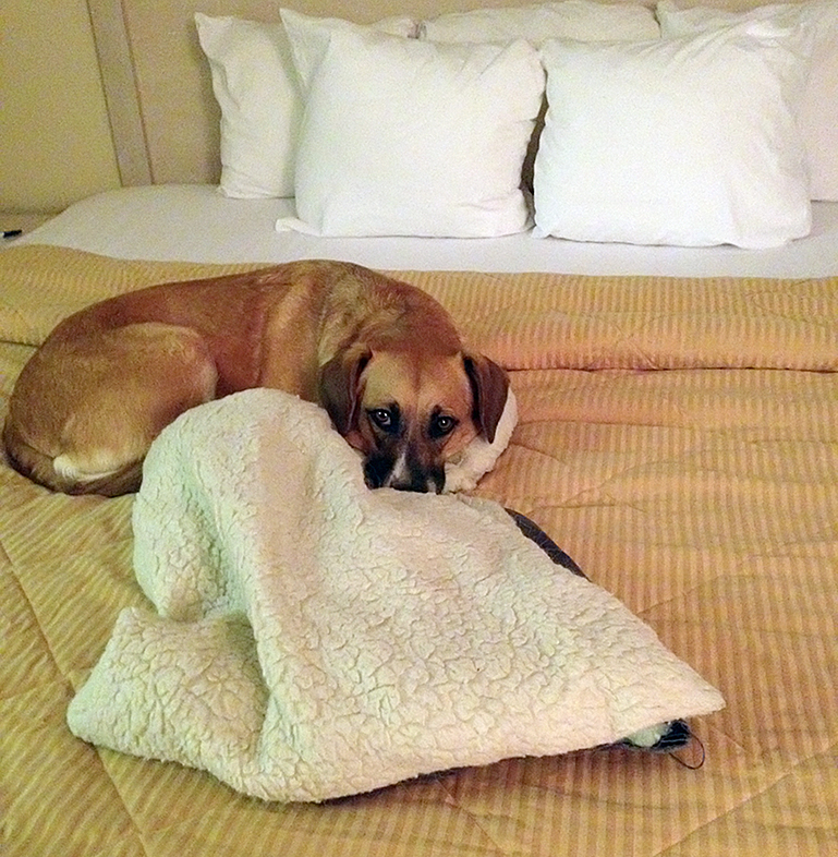
Here is Niya on her first visit to a motel:

Image

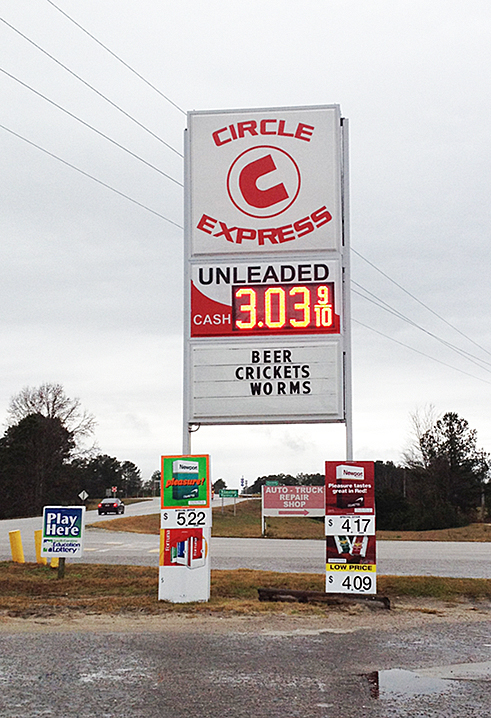
This is one of the stops we made along the way. We stopped in for the crickets, of course. . . (what are they selling crickets FOR??) and ended up getting fuel. Can you believe the price?

Image

Hans drove the whole distance, bless him. Day one of the drive was horrible with heavy rain, bad windshield wipers, wind, and tornado warnings through Georgia and South Carolina; day two was horrible as we neared DC on I-95 with crazy drivers and way too many of them going way too fast while talking on the cell phone.

It took us three weeks to go from Maryland to Palm Coast. Two days for the return trip was eerie;  we left 70 degree weather, palm trees, Spanish Moss and the slow pace of trawler life, for overnight temperatures of 35 degrees and the hectic pace of suburban Maryland.  Br-r-r-r. We’ll go back some time next week.

Overnight in Fernandina Beach

No pictures here folks, just experience. . . Tonight we are in Fernandina Beach for the second night, and we are definitely rockin’ and rollin’. The Florida Cruising Guide talks about seeing 3 foot+ seas in here, and I’m telling you I am a believer. I know we’ve seen over two feet, and when that’s coming at you from an inlet into a dock, ya gotta believe. (Here’s a question: when I get to shore will my body adjust to NO MOTION instead of CONSTANT MOTION??)

 Hans got up three times last night to add stern lines. I’m listening to the lines tonight and I hear sawing. Hope there are more lines where we need them, in all the right places. Thank you Hans.


Fernandina Beach

We saw this house yesterday on our approach into Fernandina. A little taste of the architecture to come, as Fernandina Beach was apparently an early “snowbird” destination and the flocks built many Victorian homes here . . .

Image

as well as what I would call “Florida Beach Bungalows.”

Image

. . . and a reminder that this is a town with not one but TWO paper mills, one north of the marina —

Image

Image

— and one south of the marina.

Image

Yes it’s a charming town!

Image

There are many gift shops and little restaurants so it’s quite obvious that they are geared toward the tourist industry. They’ve done a nice job maintaining the appearance, including the use of the original railroad station as the Chamber of Commerce Visitor Center. I’m guessing that the “normal” clientele here is different from who we are: for the most part everything is either too glittery, too cute, or too expensive for us. Granted that may have something to do with the fact that we are living in a tiny space which has no room for 8” glass Christmas ornaments, or 10” carved wooden pirates, and that we are trying to be as frugal as possible. Nonetheless, the buildings are definitely Southern. From the Post Office. . .

Image

. . . to the Florida House Inn, which apparently is the oldest surviving Inn in Florida.

Image

I thought this one was pretty cool, with its wonderful paint choices. . .

Image

And I took this one to remind myself that yes indeed we are in Florida, where hibiscus plants grow outside quite happily in the warm sunshine along Center Street in Fernandina Beach . . .

Image

even though today it was 48 degrees, misting rain, and wind howling at 15 to 20 knots early, finally dying down to 10 to 15 around noon. I am SO GLAD I brought earmuffs, gloves, and my fleece-lined LL Bean Windbreaker. I used them all today.

And I am SO GLAD we weren’t going out St. Andrew Sound into the ocean today. Geesch.

This evening while I was taking Niya for her walk, we met up with two dogs we had met in St. Simons Island — different dog-walker, but I recognized the dogs. He was from the blue sail boat that left moments before we did yesterday morning from St. Simons Island, and they only arrived here this afternoon. He said that they had gone aground in The Crooked River, along with another sail boat. They were fortunate that they were right side up for the whole four hours they waited for the return of the tide. The other sail boat was not so lucky, as they were lying on their side. We’ve not only been lucky (because I KNOW we’ve gone through shallows when we’ve had no business being there!) but I also know that Hans has worked hard to learn how to read the water. Which of course only works when conditions are right, and that’s where the luck part comes in.

So here’s the thing about shrimp and grits. I had a great experience in Georgetown, SC, where the shrimp boats come in. It was really good, tasty, and worth another try. Tonight we had dinner at Brett’s Waterway Cafe, right here at the Fernandina Harbor Marina. Reportedly “good value for the money, but a bit pricey.” I had shrimp and grits, and it BLEW AWAY what I had in Georgetown! There was SO MUCH FLAVOR! Red and green peppers (just the right amount!), fresh diced tomatoes, carrots (just a few), the ham and sausage were more evident, smokier, tastier, bigger chunks, but not too many of them. The shrimp. . . the shrimp were tender and tasted like shrimp, sweet tender shrimp, not rubbery. The menu boasted, “Tasso Ham, Red-Eye Gravy, Anson Mills Cheese Grits.” I shook the hand of the chef after this one, literally,­­­ and told him that this Northern woman had been converted to Southern with his shrimp and grits. Oh my oh my oh my. . . . Y’all heah this now? There’s gonna be a bit a’ drawl from this New Yawkah. I have eaten Suthin’ heaven.

Image

Georgia Shallows, and Florida at last!

We left Beaufort Monday morning, and stopped at Isle of Hope, in Georgia. Isle of Hope is a fascinating place, I think worth a longer visit. Not because there’s lots to do there, but it’s GORGEOUS! The marina is nestled into a big loop in the channel. Hey, it’s ALL loops in the channel in Georgia, ALL OF IT! Running along the edge of the island facing that loop is a road with some of the most charming, lovely, I-could-happily-live-in-any-one-of-them homes. Truly. Southern homes, porches, windows, more porches. White picket fences.

Lining the streets, giant trees dripping with Spanish Moss. Suddenly I saw where the ever-present “ghost stories” of the south come from — these swaying, silver ghosts with (somehow?) sad faces. Towering Magnolias, leaves crisp with the season, clicking softly as you pass. Then a skitter of . . . what? Behind you. I turned around to look several times, and there was. . . the ghost of the south, and I was pleased.

Well, I wax poetic, but I didn’t carry a camera and I am so, SO SORRY! I just know I will go back there and take pictures so I can share it. But, until you hear the soft clatter of ghost feet behind you, you will just have to believe me that they live on the Isle of Hope.

Georgia is shallow water. Winding water. This was a long, long day. We missed the Skidaway Bridge just a few miles down the ICW by three minutes. It was dark when we left at 6:45 (as in “night time” dark) and overcast, and we lost time getting lost. Well. A mark here, a dock and dockhouse sticking WAY out into the channel there. . . We watched the bridge close as we arrived. So. One hour of circling at idle. But we had another 9 hours to go to St. Simons Island, in not such great weather. Fog, drizzles.

Image

Did I say that Georgia is shallow?

Image

At one point we saw .6’ under the keel. THAT is nerve-wracking. Land on either side is way far away, but evidently we could just about walk across if we stepped out of the “channel.” So you say, if we run aground we could “push her off?” I’m thinking NO. It’s likely to be mud, which is okay really because if we DO run aground we can “power off.” Hopefully.

This is a “range.” Sometimes the waters are so wide, and the channel so narrow, that you can wander off between point “A” and point “B.” You’re heading straight for point B, right? But how far away from point A have you strayed? So they put up ranges. You’re supposed to keep the front verticals in line with the verticals behind. This is useful particularly if you don’t have all of the electronic aids that we do, but unfortunately many of these haven’t been maintained, so one or the other will be missing.

Image

Georgia is layers.

Image

Georgia is birds.

Image

These pelicans are taking advantage of “the ground effect,” floating on a cushion of air between their wings and the water surface.

Image

Image

Georgia is rain. In Georgia we went into the ocean. This is what our chartplotter was showing. Our boat is inside the concentric circles.

Image

Image

St Andrew Sound was OUT THERE! And here is the light and also the lightkeeper’s house. YOU CAN HAVE IT! I cannot imagine being so isolated. Vulnerable.

Image

Image

Niya didn’t like this, as we were in the swells of The North Atlantic. I didn’t like it either. Thankfully it lasted less than two hours before we were back in protected waters.

Georgia is a spaghetti of channels, rivers, creeks, some so shallow you gulp and stop looking, others so deep you can’t believe you’re seeing 50 feet, not .5 foot.

Image

We are in Fernandina Beach, FLORIDA. I’d forgotten how much industry there is here. We’ll stay for two nights and I hope will be able to enjoy the town. Although the rain seems to have moved in with some determination, we won’t let it ruin our visit.

We Have Arrived!

We’ve been underway for two weeks and I think today. . . we are exactly where we should be. Until now we’ve been racing south, spending two nights only in Portsmouth and then last night and the night before in Charleston, the rest were single nights, get up at six, or seven, and GO!

Yesterday was my first taste of BEING somewhere (other than Portsmouth, which was still north, cold, and limited) and I fell for it. So when we arrived in Beaufort (Biew, not Boh) today and I took Niya into the park and we saw red bows on the palm trees, and bars and restaurants and cafes along the waterfront, I handed over the credit card for not one but two nights. We’re slowing down, folks, we are slowing down.

Image

Hans and I stopped in at Luther’s, just to pick any bar. For $10 (including tip) he had a fancy beer and I had one of the very best Bloody Marys I’ve ever had. We told the bartender we’d see her again tomorrow. Wonderful bar scene, lots and LOTS of activity, and THEN . . . . we found out that tonight was the “Light Up the Night” Boat Parade for the holidays, and . . . well. It was wonderful.

Image ImageImageImageListening on the radio to the staging and preparation of it all, and there were at least two dozen boats, each one showing effort and creativity, large and small, and we had FRONT ROW SEATS, as they pulled them all together about a half mile south of here and then paraded past, and went round and round.This isn’t a great photo, but it does give a sense of it. . . Image

What a sense of SEASON, and COMMUNITY! We shared it with MTOA friends Judy and Jim Foster from Tug-A-Long.

THEN. . . I cooked the flounder from Georgetown. It was a three-pan meal on a one-pan stove. (The breaker flips if you ask too much of it.)

Image

Parsley potatoes, skinny French green beans, and perhaps the best flounder I have ever had. Standard fare made fantastic by where it was, how we did it, and a surprisingly good (cheap) white wine.

Image

ImageTomorrow we are talking about a horse-drawn tour of the town, which is lovely. . . . WAIT. . . Does that mean that we are finally smelling roses??

**********************

Actually, I must also write about the trip yesterday from Charleston to Beaufort. We’ve been in and out of Sounds and Inlets, for hundreds of miles, all with rushing current in every which direction.  We cruise at 2400 rpm on our 165 hp Turbo Diesel Volvo engines. This gives us about 8.5 knots under “normal” conditions. Well these tides and currents aren’t the “normal” we’re accustomed to. Yesterday going through Watts Cut which goes from the Dawho River to the South Edisto River, we were going 4.3 knots at 2400 rpm. The other day. . . can’t remember exactly where, we were actually doing 11 knots. That will give you some idea of the effect these currents can have on our travels.

And we were VERY lucky when crossing the Coosaw River and St. Helena Sound, a BIG, WIDE STRETCH of ocean. . .

Image

We went through many areas of mud banks and “beaches” during the day, and saw at least half a dozen Wood Storks. http://en.wikipedia.org/wiki/Wood_stork (Check out the link. . . I never got a photo of one, but it’s worth a look.) They are definitely odd looking birds, and “first sightings” for both of us. And on the subject of birds, these little guys

Image

Image(we think they are Ruddy Turnstones) were camped out on the dock directly next to the boat. They seemed to have little or no fear of us. . . and there had obviously been a directive: if you’re going to poop here, stand on one foot.

******************

And here are the roses!

Image

We had lunch at Plum’s, and then a short walk back toward the place where we had seen the horse drawn carriage yesterday, and no one was there. Checked in at the marina office and they said oh yes, there are several tours, but they’re not running today because of the PARADE! So we are getting small town Americana instead of historic Beaufort.

The celebration started at about 1:30 with motorcycles. Santa (and police) in the lead, and hundreds behind, I have no idea where they were from or where they were going, but there were too many of them for the parade, I’m certain. It went on, and on, and on. Someone suggested it was the annual Toys for Tots campaign which is apparently huge for the motorcycle crowd down here. . .

The parade itself was supposed to start at 3:00 but we were somewhere near the end so it was more like 3:30. . . I am here to report that the demise of the small town parade is rumored only. THIS was spectacular!

Image

Image

It started with the Marine Corps Band. . . why, you say? Because we have Parris Island very close to here, and also the Beaufort Marine Air Base. Double dose of marines, and evidently the military does have a presence here, if only for graduations and “occasions,” such as this. I’m not sure I’d ever heard the Marine Corps Band before, but they are amazing.

Image

Image

Image

Then every cub scout pack, day care center, realtor, tractor or tow place, every Fire Company, every basketball team, and by god let’s not forget every “Queen,” “Princess,” or member of a beauty pageant or junior class court of every high school in the county must be represented. Every charter school (of which there are many!) had handouts and encouragement to join. I’m thinking every kid that WASN’T in the parade somehow managed to join it. Somehow.

What a terrific day, what a wonderful experience.

Charleston

We’ve had several days under way, with a stopover in Georgetown, South Carolina, one of my favorite little towns along the way.We stayed only one night, definitely not enough. We’ll stay several days when we head back north, for sure. Dinner out at the River Room Restaurant was delicious. I had the Shrimp and Grits. . .

Image

totally new for me! I would do it again. I was told by someone years ago that grits are a “carrier” for flavor, as they have (evidently?) no flavor of their own. So if you want sweet, add sugar, honey, etc. You want butter? Bacon? Ham? Shrimp? There you go! Well I do admit that I never tasted the grits, but man oh man, the total combination (shrimp, smoked sausage, a mild Cajun ham “gravy” which had a tomato base and slivers of ham, all on the grits which lined the bowl at the bottom) was incredible. We stayed a bit late before departing so we could visit the “Independent Seafood” place next to the shrimp boats, which opens at 8 am. I bought 2 lbs of shrimp and 1 lb of flounder filet. Fresh off the boats! YUMMMM!

Image

Travel yesterday was “interesting,” with winds and current strong but all behind us, so we were never uncomfortable, just pushed along a bit faster than we normally go. For a while we were winding our way through cypress forests — I particularly love the trees draped with Spanish Moss. I call this one “Cypress Bride. . . “

Image

. . . and this one, “Cypress Bridesmaids.”

Image

Then we were in the wide open, with some “skinny” places where the water gets shallow and channel narrows, but Hans has been able to figure out how to “read” the water, and we never saw less than 5’ under our keel, which is 4.5 feet.

Image

Entering the Charleston Harbor you are IN THE OCEAN! I cannot imagine what this place would be in a hurricane, because it’s right out there!

Image

We are in Charleston at the Charleston City Marina, and I understand why a lot of boaters from up north take advantage of the Winter Specials here. . . The facilities are great, the staff courteous, there is a van that leaves from the marina hourly to take you where you want to go, and will pick you up when you’re ready to come back.

AND. . . The city itself is delightful! The homes remind me of Annapolis style homes, small, charming, and on narrow streets, except there are a lot more of them.

Image

Image

The City Market runs for blocks, part of it heated, part not (some of the vendors were “cold” in the high 60s temperatures that we had.)

ImageImageImageYou walk through a building, cross a street and into the next. Everything from high end jewelry to leather wallets and sun glasses. But the Sweetgrass Baskets. . .

Image

I had NO IDEA about the Sweetgrass Baskets that this area is known for! They are made from local sweetgrass and longleaf pine needles (for contrast). This art (for truly, it is more than a craft!) was brought to the area by African slaves from the “Rice Coast” of western Africa. Rice was being grown here, and the knowledge and experience of the Africans was valuable to the landowners here.  In the late 17th century the woven baskets were used in the planting and harvesting of rice and other crops, but in the late 19th century the art expanded to home and decorative use. The knowledge and techniques are handed down generation to generation, and the weavers we spoke to were obviously very proud of having been given the honor to carry it on.

Image We were encouraged to consider the basket as an item to be handed down to children and grandchildren, as they will “last forever.” I couldn’t quite bring myself to come up with something in the neighborhood of $100 for a basket, but they are lovely, impressive, substantial, and will have many uses, so perhaps on our way back north I will have made that decision.

Lots of other tempting things in the market, jewelry, knitted stuff,  and the “Gullah” culture (which I assumed was primarily in Louisiana) is quite evident, with a lot of local pride and cultural influence.

One thing that I was very impressed with (in the very short day we’ve spent here!) is the evidence of a strong art/craft vitality. I think I could live here. . . . but perhaps a three month winter stay on the boat some year will satisfy. Maybe in our future. . .

In any event, I wish we could stay for a few more days right now, but if we’re going to make it home for the holidays we want to be farther south when we leave the boat.

To Sath Ca’lina

Our weather is distinctly different today, with low dark clouds threatening rain.

Image

We are still blessed with little or no wind, which is what I care about. It usually means flatter seas, pretty much the only kind I like!

Image

We’ve had many inlets, the largest being Cape Fear, below Wilmington. It’s HUGE! The sea comes in there and all of a sudden you’re going in a different direction as a current catches you.

ICW (IntraCoastal Waterway) marks are unique. Normally when you’re cruising on any waterway you have routes that you can take instead of roads. While the roads on the water aren’t as obvious, there are marks (green squares and red triangles) on poles in the water (or on cans or buoys) indicating where the channel is, and if you coordinate that with your charts you’ve got a pretty good idea of where you are and where you need to go.  When you are going into an inlet or channel or river, you keep the red triangles on the right: “red right returning.” But all the way down the coast on the ICW we keep the red on the right (which I guess means that we are “returning” south) . . . and all the way back up the coast we keep the green on the right. Unless you are in or near an inlet, or river, etc., in which case the river or inlet marks prevail. Can be VERY confusing, especially if you’ve got channels going off into several different rivers. So we’re booking along with the current in the Cape Fear River and all of a sudden I realize that the channel is wide and unobstructed by land. . . we are heading out to sea! Whoa, I don’t THINK so!! Lots of marks, green, red, red, green, red, but what I need to find is one of these:

Image

See that yellow square up there at the top? That means that it’s an ICW mark and it should be on my left. The red triangles have yellow triangles at the top. Whew!! Close one there. I am not ready to go into the ocean.

We are seeing more dolphin as we head south. I KNOW I will be able to get some great shots as we go along, but so far I’ve only managed fins.

Image

We are also seeing more pelicans too, which I love. These are the most graceful ugly creatures you can imagine! Pterodactyls are not too much in the past for these birds, and their great soft throat (which I can tell you can accommodate a fish nearly the size of the bird’s body!) is naked and floppy. But let them fly, oh my, let them fly! They coast along with wing tips like fingers, splayed along the top of the water, never quite touching but al-l-l-lmost close enough. . . I will get some photos of these birds, and hopefully do them justice.

We had lots of inlets, some of them absolutely right there, the ocean coming in. . .

Image

And how’s this for a wave of birds? Like water flowing!

Image

And more soup to nuts houses along the way. . . which ones are soup, and which ones nuts? (Frankly, I’m beginning to think they’re ALL nuts to be so close to the water these days. . . I grew up on Long Island at a time when the Army Corps of Engineers was still under the impression that they could “do something” about the ocean. My father was an architect with many very wealthy clients who managed to convince the Army Corps of Engineers to “do something” in front of their dune mansions. It never worked. Ever.)

Image

Image

We saw lots of Shrimp boats today, coming, going, drying and clearing their nets. Can I just tell you I can hardly WAIT to be able to buy fresh local shrimp and . . . marinate and grill them? No, sautee in white wine with garlic and parsely. . . with a bit of bread crumbs and olive oil? Or not. I hope to have opportunities to do it all!

Image

We are at Barefoot Marina in North Myrtle Beach tonight (wait. . . that means we’re in Sath Ca’lina!) and the last bit of our journey was through a part of the ICW called “The Rock Pile.” This is a particularly narrow part of the channel, with rock ledges on either side, some of which you can see just below the surface, or being sloshed by your wake. The bottom is hard shale or rock. You DO NOT want to touch anything here, sides or bottom. Dead center in the channel is the key, and there’s a certain “pucker factor” if you will, as you navigate this area. It only goes about 18 miles, but at 8 1/2 knots, do you know how LONG THAT IS??

Image

Image

As if we needed warning!

Sounds, Inlets and Barrier Islands

Image

12-3 2 Morehead City SunriseNot quite up to the Dowry Creek level, but I loved the billowing cloud bank . . .

We saw our first dolphins today, as we came out of Newport River and turned into Bogue Sound. I didn’t do so well with the photography on this one — I was unprepared when they surfaced directly in front of our bow!

Our first dolphins!

Our first dolphins!

Normally dolphins will speed toward a moving boat to ride the bow wave, but I’m guessing that at 8 ½ knots we didn’t provide the excitement that the speedy sports fishing boats do. They let us pass without  paying us any attention at all.

Crossing the Bogue Sound this morning we got a huge push from the current that was coming in the Beaufort Inlet, speeding us along at an unbelievable 10.1 knots. Somewhere along the way the current changed, and we dropped back to 7 knots going against the current coming in the Bogue Inlet, farther down the ICW.  Take a look at the chart here and you will see “the magenta line,” indicating the ICW, and how it winds around some of the small islands at the inlet.

Sounds, Inlets, Barrier Islands and ICW

Sounds, Inlets, Barrier Islands and ICW

Currents coming around some of those islands will sometimes be opposed to the current coming in the actual inlet itself, so our speed varies considerably, and OFTEN!

The Sounds are associated with inlets from the ocean, and protected by barrier islands. The “Bogue Bank” seems to  be heavily developed in some areas (look out FEMA!) In many places there is a second, smaller line of barrier islands, some of which are barely dry ground, but the birds love them.

Two Kinds of Barrier Islands

Two Kinds of Barrier Islands

You can see the two barrier islands here, the closer one inhabited by birds. Look at the cormorant spreading his wings, just left of center. Bird feathers are hollow which gives them lots of insulation. But these guys dive deep for fish, holding their breath for over a minute, and after a while they get water logged. To the point where they no longer float! So they hang out like this, basking in sun, wind, air, until they can float again.

Here is a Snowy Egret that we startled out of his fishing. . . .

12-3 6 Snowy Egret

And here a flock of cormorants who we chased down the channel. The rear guys would lift as we approached, paddling and splashing, fly ahead a thousand feet or more, and then settle with the flock coming in behind them. Only to lift again! It was like watching the water flow.

Cormorants on the ICW

Cormorants on the ICW

12-3 11 Dunes on the BarrierWe went through Camp LeJeune. . . never saw a person, but a large helicopter that Hans called the “Green Giant” flew overhead and circled us for a bit. The signs about “Live Fire” are real, and a bit daunting, yes?

Entering Camp LeJeune

Entering Camp LeJeune

This was truly a gorgeous day, and we went through lovely areas. . . all different.

Beautiful Day 2

Beautiful Day 2

Another beautiful day!

Another beautiful day!

12-3 4 Prevailing Winds

It’s soup to nuts whether the homes are multi-million dollar spectacles, or your basic blue-collar inherited beach bungalow. But regardless, I still think of Sandy, and the poor people on Staten Island and Long Island shoveling the 3-5 feet of sand out of their kitchens. . . whose kitchen is safer, I wonder.

Vulnerable houses 2

Vulnerable houses 2

Vulnerable houses 1

Vulnerable houses 1

And here is my “favorite house,” which I remember clearly from our trip north over ten years ago. . . The Pink House, perched upon its own little island!

The Pink House

The Pink House

The bridges can be problematic along this stretch. Not the ones that are at a fixed height of 65 feet, but the old swing bridges and bascule bridges. They are almost always on a schedule, with very few opening “on demand.” Sometimes it’s “every hour on the half hour,” sometimes it’s “on the hour only.” Well, if you get to the bridge that opens on the hour, and the next bridge down doesn’t open until the next “on the hour,” but it’s three miles away. . . well. You have to be very patient really.

When we arrived at our marina, the Seapath Yacht Club Transient Docks in Wrightsville Beach, a fishing boat came in at the same time. Directly next to us was one of the fish cleaning stations. They had quite a successful day apparently, with these only a sample of what they caught.

Sea Trout, a successful day

Sea Trout, a successful day

Cleaning the Catch and telling tales

Cleaning the Catch and telling tales

It was fascinating listening to the captain as he cleaned the fish for the men who had hired him. He said there was a Great White Shark that came into Myrtle Beach last week, traveling up and down the coast (sniffing out a tantalizing treat??)  and then went back out again to head south. She was tagged, so they “knew” her. She weighs over 3,000 pounds — so cool that she is being tracked, I love it! He said that there was a hump back whale just off the coast recently as well. Wonderful stuff.

We have a lovely view over some of the marshy islands next to the dock, as we are on the “face dock” with a side tie — our favorite as it’s easy to get off in the morning.

12-3 19 View from Our Dock

Someday soon we will stop in a place where we can stay for a few days or more, and smell some roses. (NOT here, for sure, at $2.00 a foot. . . ) One of our good boating friends, Jim Roberts (a wise and seasoned cruiser!) said in an e-mail today that if we keep up this pace we will be in Cuba before Christmas.

That’s just how it feels! Gotta slow down.

Coinjock. . . to our first grounding!

12-1-2012

We got off at 7 this morning with two other boats, soon to be joined by two more. The protected little pocket at the marina was frosty but fog free, however once we really got under way we were in dense fog. DENSE. As in: can you see water beyond the bow? Can you see the shore? Thank heavens for radar. Radar, chartplotter, gps, etc., etc. (Some time soon I will photograph the “navaids” we have on board . . . “Navigational Aids”. . . and explain what they all do to make us feel more comfortable with figuring out where we are and what we’re seeing.) We could “see” the marks, the shoreline, and the other boats. Our two chart plotters keep track of us via GPS, so we know when we’re in the channel, but imagine seeing only wooly white in front of the boat!

Coming out of Coinjock

Coming out of Coinjock

The first trouble mark (according to Active Captain, our primary internet resource for warnings) was going to be between the Green 127 and Red 128. Well. . . it was WAY-Y-Y before that! The fog was only spotty now, and we were following two boats, a small sportfisher was in the lead, a very large one behind him, and they both stopped mid-channel. I’m sorry they didn’t just say hey, we’re aground. . . Our plan had been to go farther out than the “normal” channel, but they just muddled around, not giving us any idea of what was happening. On the charts there are warnings all through this area about shoaling — which is when the waves and currents move the shallows around, sometimes creating surprise grounding areas. Both boats were backing, turning, searching for the “deep water,” which is only 7 or 8 feet deep in this area. So pretty soon we saw 6’, 4’, 2.5’, . . .  .5. . . Mid channel of course, which is what they warn you about farther south. Ultimately it was not a problem as it was a soft grounding. We all ultimately maneuvered off the shoal and continued in spotty fog, but it was an area of shoaling that we hadn’t expected, so we posted it to both Active Captain and the SSECN.

12-1 Off the end of the world

This is a fascinating area of cuts, canals, and sounds. Cuts are (as it sounds) narrow cuts through what would otherwise be extensive land areas, canals I would describe as “cuts with a history,” so they’ve been there for a long time and everyone knows they’re there and they are established waterways, sounds are IMMENSE! Wide and shallow water, an ocean inlet, and a marked channel which helps the cruiser cross what would otherwise be a flat plain of shallow water. Think of it as a road crossing a desert. You don’t want to wander off the road.

Alligator Pungo Canal, where we've been

Alligator Pungo Canal, where we’ve been

Alligator Pungo Canal, our wake

Alligator Pungo Canal, our wake

One of the things that I find most fascinating here, in the calm waters of this narrow channel, are the reflections. We’ve all seen kaleidoscopes, which are images that are divided by mirrors, usually into eight pieces. Well here we have kaleidoscope images that are only divided in two pieces. . . and they are REAL!!

Kaleidoscope 1 in the Alligator Pungo Canal

Kaleidoscope 1 in the Alligator Pungo Canal

12-1 Alligator Pungo Canal kaleidoscope 312-1 Alligator Pungo Canal kaleidoscope 2

We have stopped at the Dowry Creek Marina for the night, which is a well known, highly revered, oft visited, marina on the ICW. Mary, who owns and runs the place makes people feel comfortable and easy. There is a traditional BYO gathering in the “club house” at 5 or 5:30, so all the cruisers who have come in can gather and share “war stories” and histories. It was AWESOME! Lots of wonderful people on interesting boats, LOTS of stories to share. And a man named Ted, who had arrived on a DeFever 57 called “Boomer Too,” had oysters. . . Chesapeake Bay oysters. . . and he kept them coming, shucking them, and finally steaming them in the microwave. . . I gave Ted a hug, and a kiss, and my earnest, heartfelt thanks for a spectacularly delicious and very special Happy Hour. WOW!!!!! (Sorry I didn’t take pictures, but those who love oysters know what they looked like, those who do not have no desire to see them.) I’m just sorry that we can’t bring Ted and his oysters along on the next leg of our journey with Aqua Vitae.

12-2-12 To Morehead City

Dowry Creek Sunrise

Dowry Creek Sunrise

12-2-2 Dowry Creek Sunrise

Pardon me if I plaster this blog with sunrise pictures from Dowry Creek Marina. . . I got too many good ones and couldn’t narrow it down any more than this!

Our trip today was down the Pungo River to the Pamlico Sound (one of the four most dangerous bodies of water on the ICW, according to the chart book. . .) to the Neuse River (another one of the four most dangerous bodies of water on the ICW!) to Adams Creek Canal and on to Morehead City, which is on the coast of North Carolina. Here is what we saw entering the Pamlico Sound.

Pamlico Sound, the dark areas are "wind gusts. . . "

Pamlico Sound, the dark areas are “wind gusts. . . “

12-2-6 Pamlico Sound to Neuse12-2-7 Pokey Hokie on the Neuse

And here is the Neuse River (“Pokey-Hokie” has been with us for several days. . . it’s what happens, you see some of the same folks at the next stop.)

I will tell you that this kind of “danger,” nail-biting, palms sweating, heart thumping, I will take EVERY DAY for the rest of this journey. This is why we call what we’re doing “low adventure.” We just don’t like the “high” kind!

Turning south from the Neuse River we entered Adams Creek Canal, which is very much like other Canals, Cuts and Channels we’ve been through. But this one is north of Beaufort, NC (pronounced “bow” as in archery, unlike Beaufort, SC pronounced “biew” as in view) and Morehead City, NC. This is an up and coming area, and there is evidence along the canal that developers are trying to take advantage of the location.

Adams Creek Canal pre-development

Adams Creek Canal pre-development

Adams Creek Canal hopeful of development

Adams Creek Canal hopeful of development

Waterfront lot for sale, including lamp post and dock. . .  this is called VERY hopeful development!

Waterfront lot for sale, including lamp post and dock. . . this is called VERY hopeful development!

Our dockage tonight is in a marina called the Morehead City Yacht Basin. It’s full of sport-fisher boats, all sparkling bright white and clean. . . when we first arrived we watched a man wash his boat for a good hour, scrubbing, hosing, wiping. . . and all I could think was that if we had used the hose like that on Aqua Vitae we would sweep an awful lot off crap off the decks, side decks, fore deck, and aft deck. We would lose lines, buckets, rags, and a number of other items that might or might not be useful when we get to a place where we might start STOWING STUFF. I tell Hans we look like we are from West Virginia, with everything but a tire planted with pansies in the front yard. We’re just not READY to be clean, and if we admit that we don’t have to be embarrassed by it. . . do we?

Great Bridge, VA to Coinjock, NC

There was definitely frost on the docks this morning, and on the decks.

Morning fog on the Virginia Cut

Morning fog on the Virginia Cut

It was 32 degrees when we left the dock at Great Bridge Bridge. Met up with our dock mates at the Centerville Turnpike Swing Bridge.

"Southern Grace" at the Swing Bridge

“Southern Grace” at the Swing Bridge

There are a surprising number of boats that RUSH to the bridge or lock to hang out, circle, shift gears. They’ll pass you going as fast as they can. . . it’s 7:10, the bridge will not open until 7:30, and they’re going 8 knots for the next half mile. . . just hangin’ out.

Virginia Cut 2

The Virginia Cut winds south from Portsmouth through low marsh. It’s lovely and barren.

Virginia Cut 2

Virginia Cut 2

Virginia Cut 3Ultimately it opens into the Currituck Sound, oddly exaggerated open space after the winding cut, but the channel through the wide water is just as narrow, with the chart showing depths of 1 or 2 feet in many places. The course is clearly marked with frequent marks.

The ocean is right over there!Currituck Sound

Tugs come through, this one from South Carolina.

Tug Coming 1Tug Coming!Island Express tug

We tied up at the Coinjock Marina, and had a great dinner at the Marina Restaurant.  I had the fried oysters and crab cake combo. And “hesh peppies” of course (deep fried cornbread, right? (“Hush puppies” for those north of here.) The oysters were small, plump and sweet, perfectly cooked. I should have skipped the crabcake. . .